Difference between revisions of "File:Daleldhura GEarth map.jpg"
(This is a map created using Google Earth showing the various deployments in Daleldhura district.) |
(No difference)
|
Latest revision as of 04:25, 13 August 2009
This is a map created using Google Earth showing the various deployments in Daleldhura district.
File history
Click on a date/time to view the file as it appeared at that time.
| Date/Time | Thumbnail | Dimensions | User | Comment | |
|---|---|---|---|---|---|
| current | 04:25, 13 August 2009 | 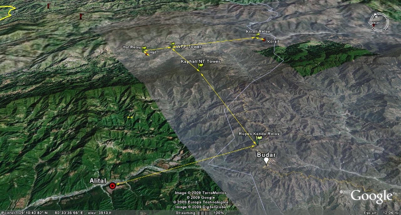 | 800 × 429 (339 KB) | Nhorning (talk | contribs) | This is a map created using Google Earth showing the various deployments in Daleldhura district. |
File usage
There are no pages that link to this file.