File list
This special page shows all uploaded files.
| Date | Name | Thumbnail | Size | Description | Versions |
|---|---|---|---|---|---|
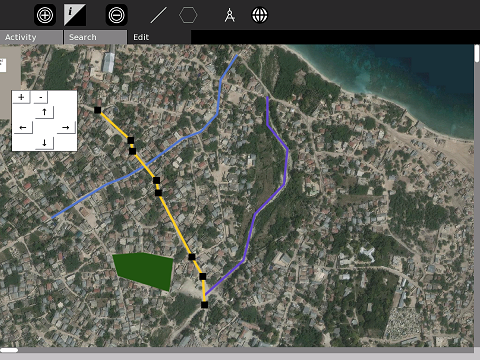
| 22:46, 7 February 2010 | OfflineMapPolyline.png (file) |  |
314 KB | 2 | |
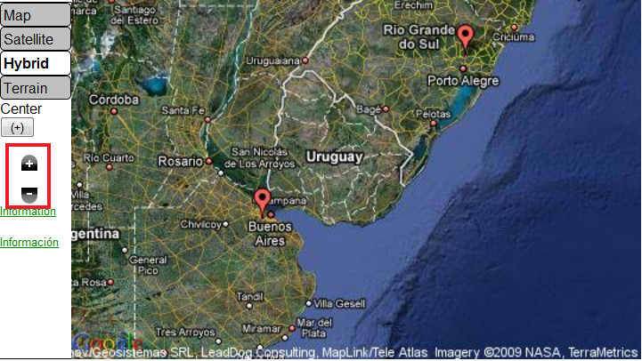
| 22:17, 28 January 2010 | GoogleMapEmbed.png (file) |  |
264 KB | {{CC-BY-SA}} Satellite image copyright of Google. Reproduced here for education / software tutorial purposes. | 1 |
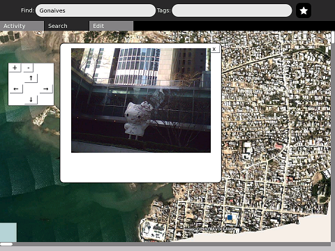
| 20:21, 28 January 2010 | AddingPhotosScreenshot.png (file) |  |
305 KB | {{CC-BY-SA}} Uses satellite photo of Gonaives, public domain from NOCEANO | 2 |
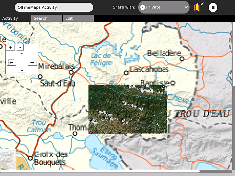
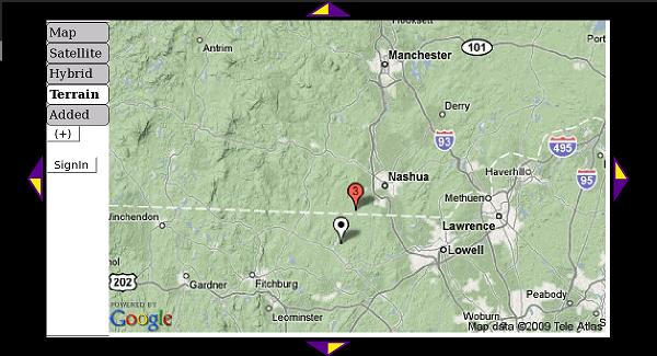
| 20:19, 28 January 2010 | PortAuMap.png (file) |  |
185 KB | 4 | |
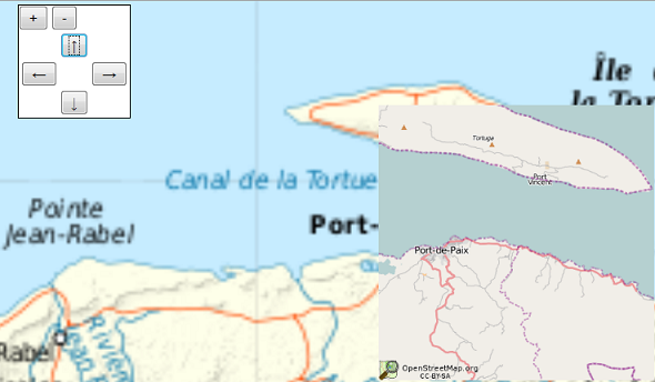
| 03:33, 27 January 2010 | OsmEmbed.png (file) |  |
133 KB | {{CC-BY-SA}} contains CC-BY-SA data from OpenStreetMap.org | 1 |
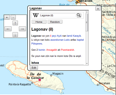
| 00:51, 25 January 2010 | LagonavWiki.png (file) |  |
89 KB | Embedding using '''wikiHT::''' code | 1 |
| 04:32, 7 November 2009 | Piechart1M.png (file) |  |
4 KB | 3 | |
| 04:18, 7 November 2009 | Barchart2M.png (file) |  |
20 KB | 2 | |
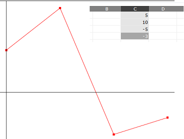
| 04:13, 7 November 2009 | Linechart3M.png (file) |  |
27 KB | 1 | |
| 04:08, 7 November 2009 | Linechart2M.png (file) |  |
19 KB | 1 | |
| 04:07, 7 November 2009 | Linechart1M.png (file) |  |
4 KB | 1 | |
| 03:48, 7 November 2009 | Piechart2M.png (file) |  |
18 KB | 1 | |
| 03:47, 7 November 2009 | Barchart1M.png (file) |  |
4 KB | 1 | |
| 00:13, 7 November 2009 | Map-Screenshot.jpg (file) |  |
573 KB | 2 | |
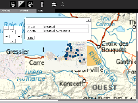
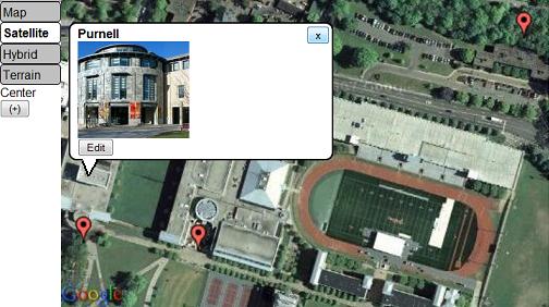
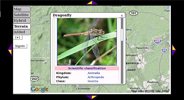
| 14:09, 5 September 2009 | InfoMarkers.jpg (file) |  |
34 KB | Satellite view and info markers in Map activity | 1 |
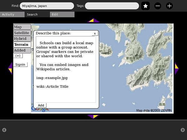
| 23:14, 25 August 2009 | Map-AddToWiki.jpg (file) |  |
42 KB | Adding a placemark to OurMaps, the map wiki | 1 |
| 23:14, 25 August 2009 | Map-EmbedWiki.jpg (file) |  |
43 KB | A frame from Simple Wikipedia's mobile site is embedded in this wiki-placemark | 1 |
| 23:13, 25 August 2009 | Map-WikiCluster.jpg (file) |  |
41 KB | Multiple markers on OurMaps (map wiki), close to each other, appear as a numbered cluster | 1 |
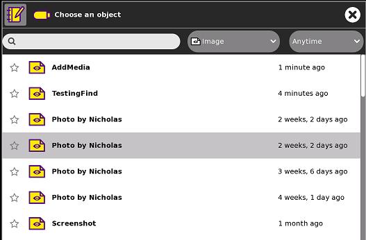
| 23:13, 25 August 2009 | Map-SelectMedia.jpg (file) |  |
25 KB | Selecting media to embed onto the map | 1 |
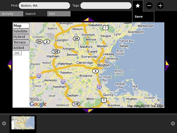
| 23:12, 25 August 2009 | Map-SavedMap.jpg (file) |  |
52 KB | Making a SavedMap object | 1 |
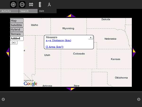
| 23:11, 25 August 2009 | Map-MeasureOn.jpg (file) |  |
27 KB | Starting the Measure feature | 1 |
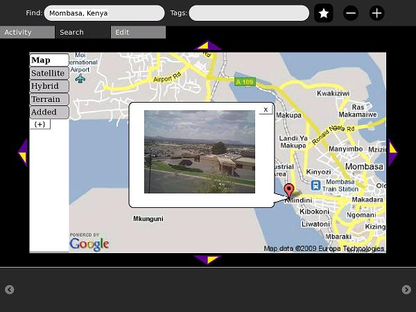
| 23:11, 25 August 2009 | Map-MediaIsOn.jpg (file) |  |
41 KB | You can embed media on the map | 1 |
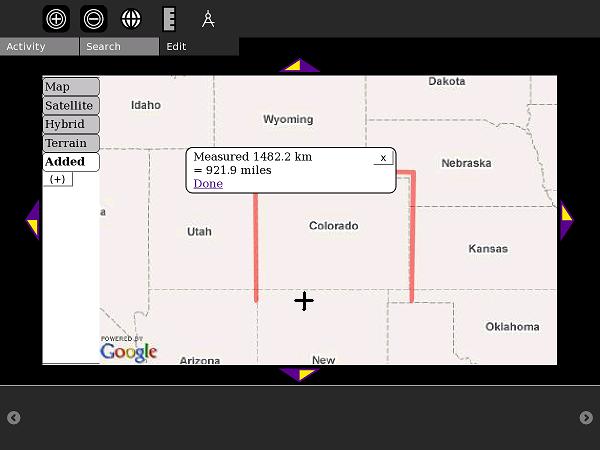
| 23:10, 25 August 2009 | Map-MeasureDistance.jpg (file) |  |
27 KB | Measuring a polyline-distance - in this case, the perimeter of Colorado | 1 |
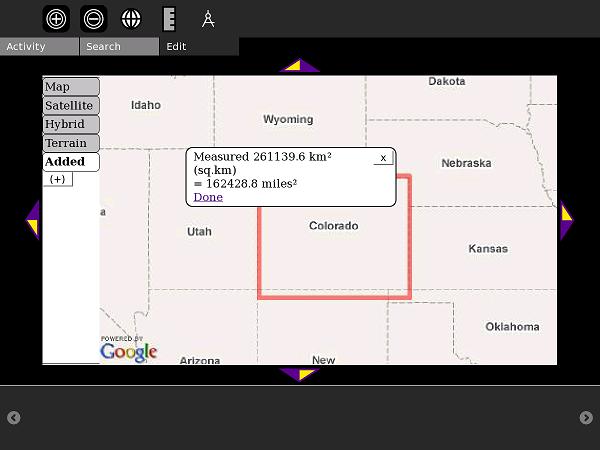
| 23:09, 25 August 2009 | Map-MeasureArea.jpg (file) |  |
28 KB | Measuring a rectangle area (Colorado and Wyoming are good to try) in the new Map activity | 1 |
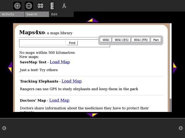
| 23:08, 25 August 2009 | Map-MapLibrary.jpg (file) |  |
34 KB | Searching the Map Library in the new Map Activity | 1 |
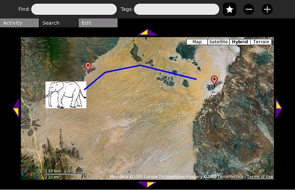
| 23:08, 25 August 2009 | Map-ElephantMap.jpg (file) |  |
52 KB | A sample map from the Map Library. This map illustrates a real-life use of GIS: conservation of elephants. | 1 |
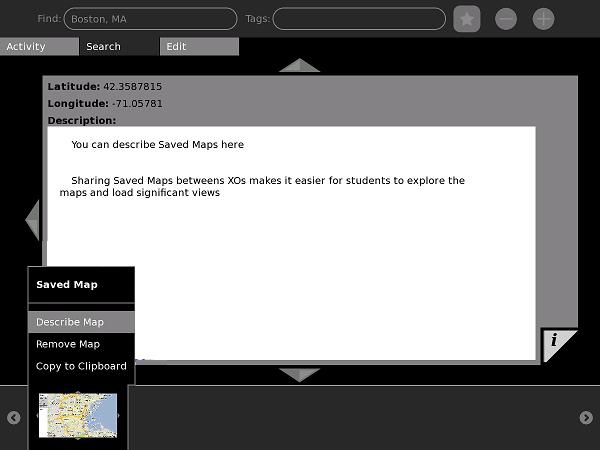
| 23:07, 25 August 2009 | Map-DescribeSaveMap.jpg (file) |  |
26 KB | Describing SaveMap objects in the new Map activity | 1 |
| 23:06, 25 August 2009 | Map-AddMedia.jpg (file) |  |
4 KB | Adding media to the new Map activity | 1 |
| 17:22, 12 June 2009 | MapStats8.png (file) |  |
30 KB | 1 | |
| 17:10, 12 June 2009 | MapStatsIcon.svg (file) |  |
4 KB | 1 | |
| 00:52, 12 June 2009 | MapStats3.jpg (file) |  |
34 KB | 2 | |
| 00:52, 12 June 2009 | MapStats2.jpg (file) |  |
46 KB | 2 | |
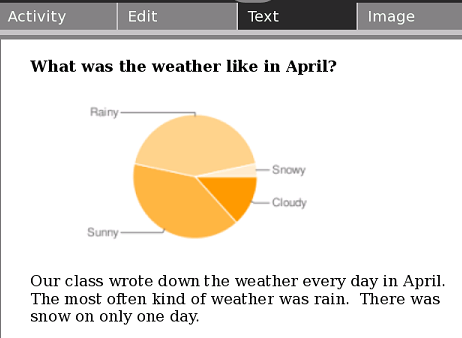
| 00:40, 12 June 2009 | Piechart2.png (file) |  |
19 KB | 3 | |
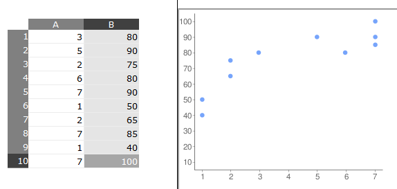
| 00:22, 12 June 2009 | Scatterchart2.png (file) |  |
13 KB | 2 | |
| 00:22, 12 June 2009 | Scatterchart1.png (file) |  |
12 KB | 3 | |
| 00:22, 12 June 2009 | Usedchart.png (file) |  |
32 KB | 2 | |
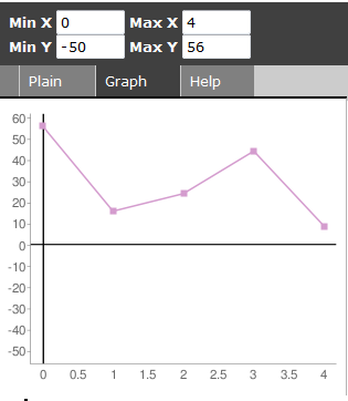
| 00:18, 12 June 2009 | Linechart6.png (file) |  |
12 KB | 1 | |
| 00:13, 12 June 2009 | Linechart5.png (file) |  |
9 KB | 3 | |
| 00:13, 12 June 2009 | Linechart4.png (file) |  |
15 KB | 3 | |
| 00:13, 12 June 2009 | Linechart3.png (file) |  |
9 KB | 2 | |
| 00:12, 12 June 2009 | Linechart2.png (file) |  |
13 KB | 3 | |
| 00:12, 12 June 2009 | Linechart1.png (file) |  |
6 KB | 2 | |
| 00:07, 12 June 2009 | Piechart1.png (file) |  |
5 KB | 2 | |
| 00:06, 12 June 2009 | Barchart1.png (file) |  |
6 KB | 2 | |
| 00:05, 12 June 2009 | Barchart3.png (file) |  |
10 KB | 1 | |
| 00:04, 12 June 2009 | Barchart2.png (file) |  |
23 KB | 4 | |
| 20:41, 20 May 2009 | MapStats7.jpg (file) |  |
19 KB | 1 | |
| 18:02, 20 May 2009 | MapStats6.jpg (file) |  |
37 KB | 1 | |
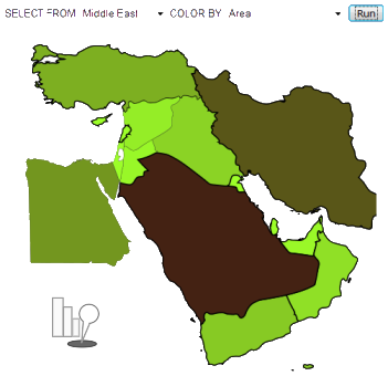
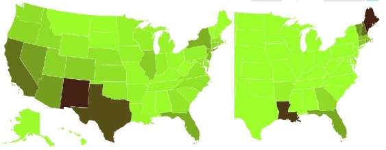
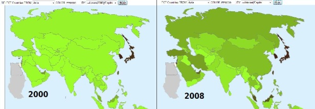
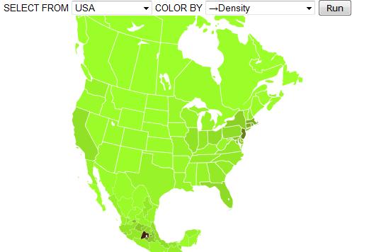
| 23:36, 15 May 2009 | MapStats1.jpg (file) |  |
15 KB | - changed continent and showing simpler query system | 2 |
| 18:18, 15 May 2009 | MapStats5.jpg (file) |  |
22 KB | 1 |