File list
This special page shows all uploaded files.
| Date | Name | Thumbnail | Size | Description | Versions |
|---|---|---|---|---|---|
| 21:28, 29 March 2010 | Map-InfoSelect.jpg (file) |  |
3 KB | updated, more obvious info marker | 2 |
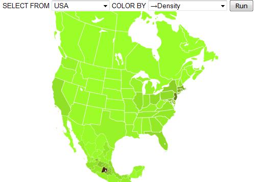
| 18:09, 15 May 2009 | MapStats4.png (file) | 4 KB | 1 | ||
| 17:10, 12 June 2009 | MapStatsIcon.svg (file) |  |
4 KB | 1 | |
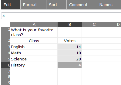
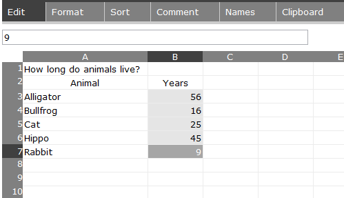
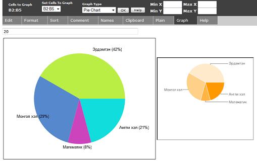
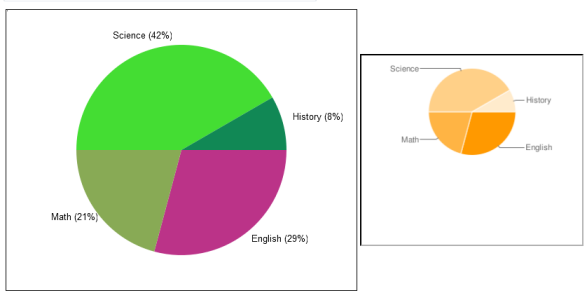
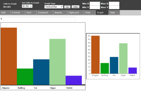
| 04:32, 7 November 2009 | Piechart1M.png (file) |  |
4 KB | 3 | |
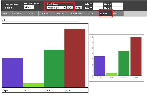
| 03:47, 7 November 2009 | Barchart1M.png (file) |  |
4 KB | 1 | |
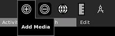
| 23:06, 25 August 2009 | Map-AddMedia.jpg (file) |  |
4 KB | Adding media to the new Map activity | 1 |
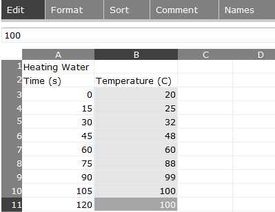
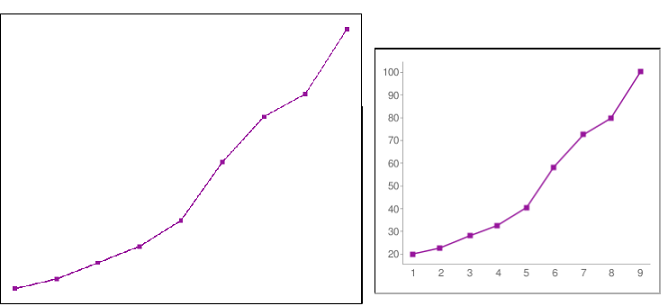
| 04:07, 7 November 2009 | Linechart1M.png (file) |  |
4 KB | 1 | |
| 00:07, 12 June 2009 | Piechart1.png (file) |  |
5 KB | 2 | |
| 00:12, 12 June 2009 | Linechart1.png (file) |  |
6 KB | 2 | |
| 00:06, 12 June 2009 | Barchart1.png (file) |  |
6 KB | 2 | |
| 00:13, 12 June 2009 | Linechart5.png (file) |  |
9 KB | 3 | |
| 00:13, 12 June 2009 | Linechart3.png (file) |  |
9 KB | 2 | |
| 00:05, 12 June 2009 | Barchart3.png (file) |  |
10 KB | 1 | |
| 00:18, 12 June 2009 | Linechart6.png (file) |  |
12 KB | 1 | |
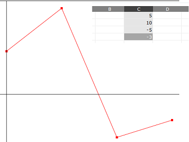
| 00:22, 12 June 2009 | Scatterchart1.png (file) |  |
12 KB | 3 | |
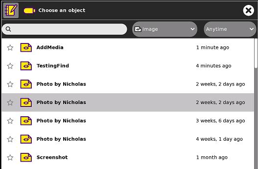
| 14:11, 23 December 2010 | MediaGuide-ForaScreen.jpg (file) |  |
13 KB | 2 | |
| 00:12, 12 June 2009 | Linechart2.png (file) |  |
13 KB | 3 | |
| 00:22, 12 June 2009 | Scatterchart2.png (file) |  |
13 KB | 2 | |
| 14:19, 23 December 2010 | MediaGuide-BlipScreen.jpg (file) |  |
15 KB | 1 | |
| 00:13, 12 June 2009 | Linechart4.png (file) |  |
15 KB | 3 | |
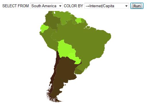
| 23:36, 15 May 2009 | MapStats1.jpg (file) |  |
15 KB | - changed continent and showing simpler query system | 2 |
| 03:48, 7 November 2009 | Piechart2M.png (file) |  |
18 KB | 1 | |
| 04:08, 7 November 2009 | Linechart2M.png (file) |  |
19 KB | 1 | |
| 20:41, 20 May 2009 | MapStats7.jpg (file) |  |
19 KB | 1 | |
| 00:40, 12 June 2009 | Piechart2.png (file) |  |
19 KB | 3 | |
| 04:18, 7 November 2009 | Barchart2M.png (file) |  |
20 KB | 2 | |
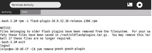
| 14:05, 23 December 2010 | MediaGuide-FlashGnash.jpg (file) |  |
21 KB | {{CC-BY-SA}} | 1 |
| 18:18, 15 May 2009 | MapStats5.jpg (file) |  |
22 KB | 1 | |
| 00:04, 12 June 2009 | Barchart2.png (file) |  |
23 KB | 4 | |
| 14:13, 23 December 2010 | LibrivoxScreen.jpg (file) |  |
23 KB | 2 | |
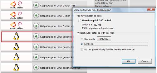
| 14:09, 23 December 2010 | FluendoScreen.jpg (file) |  |
23 KB | {{CC-BY-SA}} | 1 |
| 23:13, 25 August 2009 | Map-SelectMedia.jpg (file) |  |
25 KB | Selecting media to embed onto the map | 1 |
| 14:12, 23 December 2010 | MediaGuide-WikScreen.jpg (file) |  |
25 KB | 2 | |
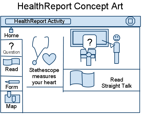
| 14:44, 24 September 2010 | HealthReportConceptArt.png (file) |  |
25 KB | {{CC-BY-SA}} | 1 |
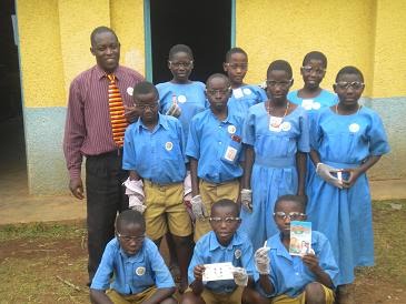
| 00:18, 31 October 2010 | KasiisiWaterTesting.jpg (file) |  |
26 KB | {{CC-BY-SA}} Water testing for World Water Monitoring Day | 1 |
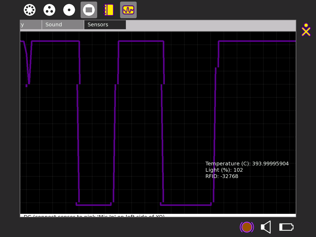
| 14:00, 26 June 2010 | Measure-Light.jpg (file) |  |
26 KB | Using the photosensor in the DigiLiteracy-modified Measure activity {{CC-BY-SA}} Nick Doiron | 1 |
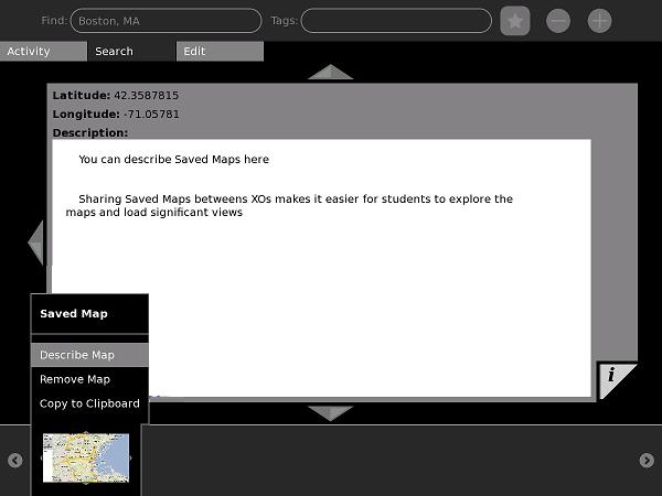
| 23:07, 25 August 2009 | Map-DescribeSaveMap.jpg (file) |  |
26 KB | Describing SaveMap objects in the new Map activity | 1 |
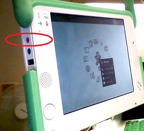
| 18:05, 26 June 2010 | HeadphonePort.jpg (file) |  |
26 KB | Attaching a sensor to the headphone port | 1 |
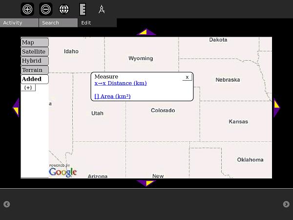
| 23:11, 25 August 2009 | Map-MeasureOn.jpg (file) |  |
27 KB | Starting the Measure feature | 1 |
| 04:13, 7 November 2009 | Linechart3M.png (file) |  |
27 KB | 1 | |
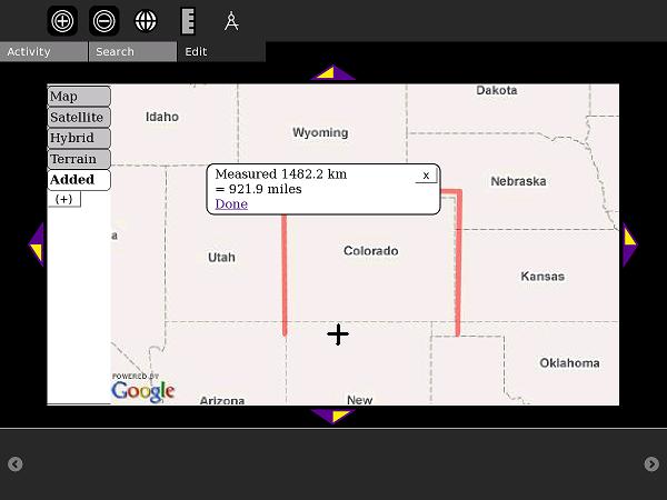
| 23:10, 25 August 2009 | Map-MeasureDistance.jpg (file) |  |
27 KB | Measuring a polyline-distance - in this case, the perimeter of Colorado | 1 |
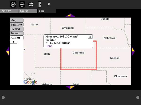
| 23:09, 25 August 2009 | Map-MeasureArea.jpg (file) |  |
28 KB | Measuring a rectangle area (Colorado and Wyoming are good to try) in the new Map activity | 1 |
| 17:22, 12 June 2009 | MapStats8.png (file) |  |
30 KB | 1 | |
| 00:22, 12 June 2009 | Usedchart.png (file) |  |
32 KB | 2 | |
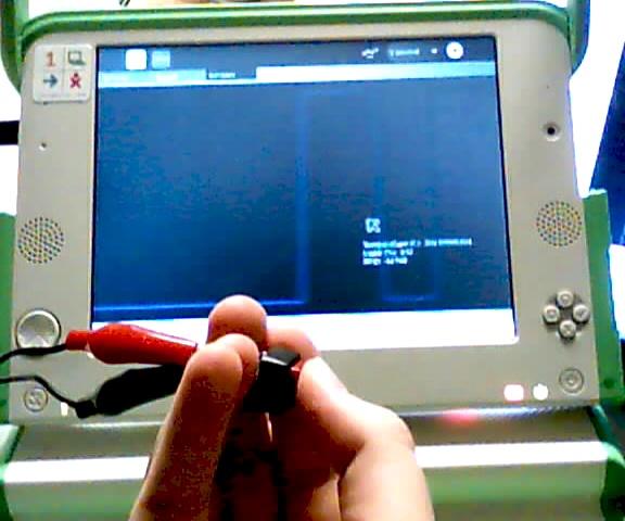
| 13:55, 26 June 2010 | Measure-Button.png (file) |  |
32 KB | Testing a simple switch (on/off) with Measure/DigiLiteracy activity {{CC-BY-SA}} | 1 |
| 14:08, 23 December 2010 | FluendoTerminal.jpg (file) |  |
33 KB | {{CC-BY-SA}} | 1 |
| 00:52, 12 June 2009 | MapStats3.jpg (file) |  |
34 KB | 2 | |
| 23:08, 25 August 2009 | Map-MapLibrary.jpg (file) |  |
34 KB | Searching the Map Library in the new Map Activity | 1 |
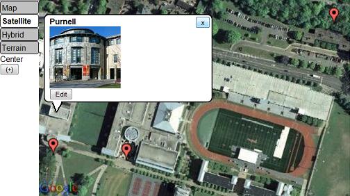
| 14:09, 5 September 2009 | InfoMarkers.jpg (file) |  |
34 KB | Satellite view and info markers in Map activity | 1 |
| 18:06, 26 June 2010 | ButtonOnscreen.jpg (file) |  |
35 KB | Using a switch, and its output in the Measure activity (DigiLiteracy mod) | 1 |