User:Ndoiron/OfflineMap: Difference between revisions
No edit summary |
|||
| Line 12: | Line 12: | ||
===Loading a KML File=== |
===Loading a KML File=== |
||
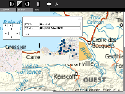
You can import regular KML (Google Earth) files with points, lines, and shapes, along with descriptions stored in the file. Many of these files can be found on [http://finder.geocommons.com/search?query=haiti GeoCommons]. This example shows MINUSTAH's list of hospitals in Port-Au-Prince. |
|||
The more detailed USAID relief map of Port-Au-Prince appears on top of a Haiti roadmap. Instead of zooming in like this, it should be possible to click and "jump" to only the Port-Au-Prince view. |
|||
'''Just added''' Import KML - these are from MINUSTAH's list of hospitals (MINUSTAH is UN Mission to Haiti) |
|||
[[Image:PortAuMap.png]] |
[[Image:PortAuMap.png]] |
||
Loading these points on one XO will transmit their location to all XOs sharing the activity. The |
Loading these points on one XO will transmit their location to all XOs sharing the activity. The descriptions can be edited by any user. |
||
| ⚫ | |||
| ⚫ | |||
| ⚫ | |||
| ⚫ | |||
| ⚫ | |||
| ⚫ | |||
| ⚫ | |||
==Making Maps== |
==Making Maps== |
||
| Line 54: | Line 40: | ||
[[Image:OfflineMapPolyline.png]] |
[[Image:OfflineMapPolyline.png]] |
||
==Downloading new basemaps== |
|||
| ⚫ | |||
| ⚫ | |||
This is a very clumsy beta version. |
|||
| ⚫ | |||
| ⚫ | |||
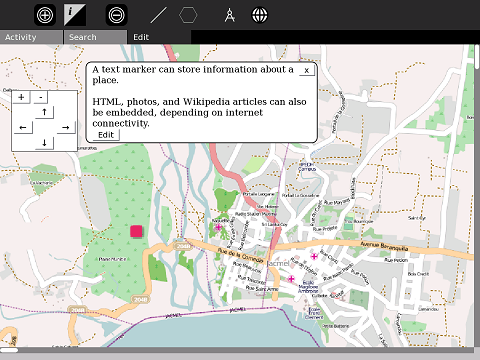
The latitude/longitude position of Jacmel is marked with a blue square. Clicking on the square reveals text information. The black square is a centering-mark for drawing additional lines. |
|||
| ⚫ | |||
| ⚫ | |||
| ⚫ | |||
| ⚫ | |||
[[Image: |
[[Image:googleMapEmbed.png]] |
||
| ⚫ | |||
As with the Map activity, you can embed a Wikipedia article using codes such as '''wikiHT::'''Lagonav (il) and '''wikiFR::'''La Gonâve, but this requires internet access. If there is a WikiBrowse-Haiti in the works, it would be possible to link to those articles. |
As with the Map activity, you can embed a Wikipedia article using codes such as '''wikiHT::'''Lagonav (il) and '''wikiFR::'''La Gonâve, but this requires internet access. If there is a WikiBrowse-Haiti in the works, it would be possible to link to those articles. |
||
Other codes, such as '''img::'''file:///home/media/picture.jpg can also work if needed. |
Other codes, such as '''img::'''file:///home/media/picture.jpg can also work if needed. |
||
| ⚫ | |||
| ⚫ | |||
==Haiti and Beyond== |
==Haiti and Beyond== |
||
This activity is being developed as a general offline map of Haiti. |
This activity is being developed as a general offline map of Haiti. To request offline maps of other countries, please contact me by editing this page or e-mailing ndoiron _at_ cmu.edu |
||
There is interest in using the activity for disaster-response in Bangladesh, and conservation in Uganda. |
There is interest in using the activity for disaster-response in Bangladesh, and conservation in Uganda. |
||
Revision as of 13:32, 6 February 2010
Starting with the Map and MapStats Activities, and creating an offline map activity where users can view maps and add their own data.
Download Beta from here: http://haiti.latest.disaster-tool.appspot.com/OfflineMaps.xo
Follow the Tutorial
Viewing Maps
Pre-loaded maps
Roadmap: Port-Au-Prince, Lagonav Island, Jacmel, Leogane, Jeremie, Saint Marc, Port de Paix
Satellite: Gonaives, Grand Goave, Miragoave
Loading a KML File
You can import regular KML (Google Earth) files with points, lines, and shapes, along with descriptions stored in the file. Many of these files can be found on GeoCommons. This example shows MINUSTAH's list of hospitals in Port-Au-Prince.
Loading these points on one XO will transmit their location to all XOs sharing the activity. The descriptions can be edited by any user.
Making Maps
Create Points, add Text
Add points to the map and add text and other information. More technical users can add HTML.
As with KML, these points appear on and can be edited by other XOs that share the activity.
Media Mapping with Record
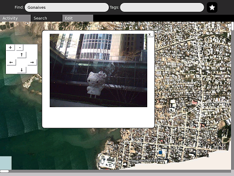
Photos, audio, and video made in Record can be placed onto the map.
Satellite photos of several cities' harbors are available from the USA's NOAA and NAVOCEANO. Only Gonaives is pre-loaded.
Add Lines and Shapes
You can now add lines and shapes, and import KML files with lines and shapes.
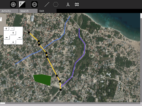
To add your own line, go to the Edit menu and select the large / option. Click on the map to start making a line (the color is randomly selected). Each point will be marked by a large black square. You can continue to move the map with the control buttons while making the line. To finish, click the / option again. To make a shape, select the hexagon option.
Downloading new basemaps
Adding from OpenStreetMap
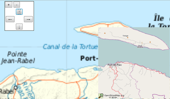
When a user can connect to the internet, they should be able to add the most recent street map of where they are looking. Since OpenStreetMap uses a Creative Commons license, the image can be stored for the next time the user looks at the map.
OpenStreetMap is the best roadmap of Haiti at present.
Adding from Google Maps
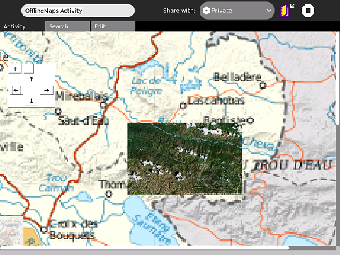
When online, a user can also add a small satellite photo from Google Maps. We are not allowed to store these images offline.
Other Screenshots
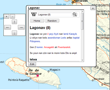
As with the Map activity, you can embed a Wikipedia article using codes such as wikiHT::Lagonav (il) and wikiFR::La Gonâve, but this requires internet access. If there is a WikiBrowse-Haiti in the works, it would be possible to link to those articles.
Other codes, such as img::file:///home/media/picture.jpg can also work if needed.
Haiti and Beyond
This activity is being developed as a general offline map of Haiti. To request offline maps of other countries, please contact me by editing this page or e-mailing ndoiron _at_ cmu.edu
There is interest in using the activity for disaster-response in Bangladesh, and conservation in Uganda.
Using XOL bundles would make it easier to quickly create, install, and switch between map sets.
