User:Ndoiron/OfflineMap: Difference between revisions
No edit summary |
mNo edit summary |
||
| Line 17: | Line 17: | ||
==Viewing Maps== |
==Viewing Maps== |
||
===Loading a KML File=== |
===Loading a KML File=== |
||
The more detailed USAID relief map of Port-Au-Prince appears on top of a Haiti roadmap. Instead of zooming in like this, it should be possible to click and "jump" to only the Port-Au-Prince view. |
The more detailed USAID relief map of Port-Au-Prince appears on top of a Haiti roadmap. Instead of zooming in like this, it should be possible to click and "jump" to only the Port-Au-Prince view. |
||
| Line 25: | Line 26: | ||
Loading these points on one XO will transmit their location to all XOs sharing the activity. The text content of the points can be edited by any user. |
Loading these points on one XO will transmit their location to all XOs sharing the activity. The text content of the points can be edited by any user. |
||
==Making Maps== |
|||
===Create Points, add Text=== |
===Create Points, add Text=== |
||
Revision as of 06:00, 25 January 2010
Starting with the Map and MapStats Activities, and creating an offline map activity where users can view maps and add their own data.
Download Alpha from here: http://haiti.latest.disaster-tool.appspot.com/OfflineMaps.xo
Objectives
- Browse set of maps of Haiti, working offline ✓
- Ability to map a latitude,longitude point ✓
- Search by name of city to get closest view ✓
- Read in a KML (Google Earth) file of points ✓
- Search by content text
- Create placemarks; add photos and text ✓
- Paste from OpenStreetMap or Google Maps when connected to internet
- Add lines, allowing roadmaps
- Read in a KML file of points and lines
- Use XOL bundles to add additional maps / cities / data
- Share points between XOs ✓
Viewing Maps
Loading a KML File
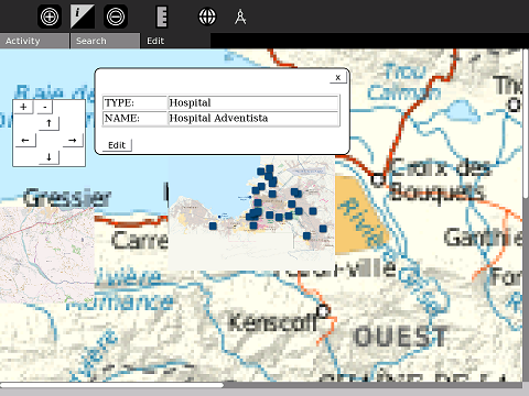
The more detailed USAID relief map of Port-Au-Prince appears on top of a Haiti roadmap. Instead of zooming in like this, it should be possible to click and "jump" to only the Port-Au-Prince view.
Just added Import KML - these are from MINUSTAH's list of hospitals (MINUSTAH is UN Mission to Haiti)
Loading these points on one XO will transmit their location to all XOs sharing the activity. The text content of the points can be edited by any user.
Making Maps
Create Points, add Text
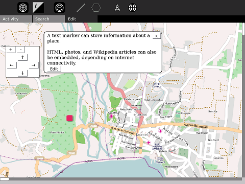
Add points to the map and add text and other information. More technical users can add HTML.
As with KML, these points appear on and can be edited by other XOs that share the activity.
Media Mapping with Record
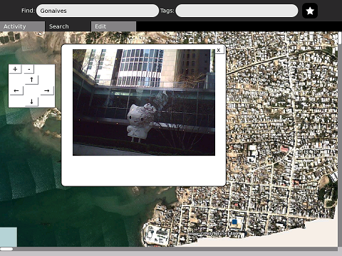
Photos, audio, and video made in Record can be placed onto the map.
Other Screenshots
This is a very clumsy beta version.
The latitude/longitude position of Jacmel is marked with a blue square. Clicking on the square reveals text information. The black square is a centering-mark for drawing additional lines.
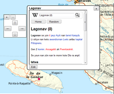
As with the Map activity, you can embed a Wikipedia article using codes such as wikiHT::Lagonav (il) and wikiFR::La Gonâve, but this requires internet access. If there is a WikiBrowse-Haiti in the works, it would be possible to link to those articles.
Other codes, such as img::file:///home/media/picture.jpg can also work if needed.


