MapStats/StatehoodQueries
< MapStats
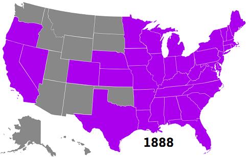
American students may know all 50 of the United States. But there have been only 50 states since 1959. Since each state in the map "knows" when it was accepted to the Union, you can query the map to see the map of the US at any point in its history:
Try the following queries and discuss their meaning:
- "territory < 1776" (independence was declared in 1776, so there are none selected)
- "territory = 1776" (original 13 colonies which declared independence in 1776)
- "statehood > 1789" (states which joined after the US Constitution was ratified)
- "statehood < 1860" (states which had to choose sides in the American Civil War)
- "statehood > 1959" (no states have been added since 1959)
Note that "statehood" does not work on maps other than USA and North America. You should use "independence" on maps of countries.
