File list
This special page shows all uploaded files.
| Date | Name | Thumbnail | Size | Description | Versions |
|---|---|---|---|---|---|
| 20:39, 25 August 2010 | AddingASensor.jpg (file) |  |
42 KB | Adding a temperature sensor to Measure/Kasiisi activity | 1 |
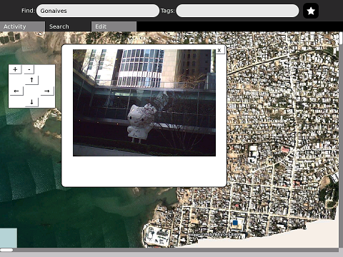
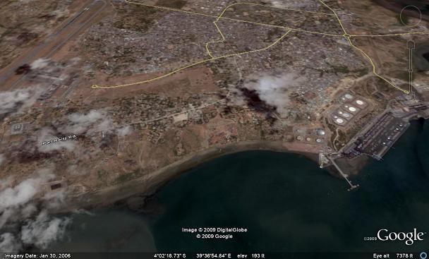
| 20:21, 28 January 2010 | AddingPhotosScreenshot.png (file) |  |
305 KB | {{CC-BY-SA}} Uses satellite photo of Gonaives, public domain from NOCEANO | 2 |
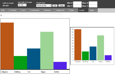
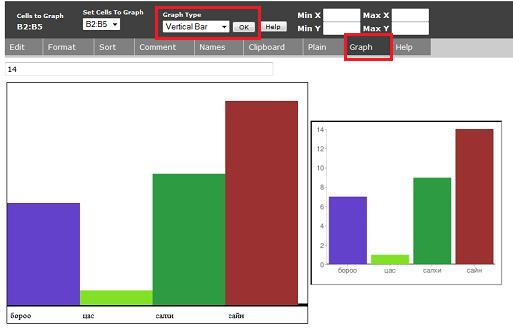
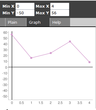
| 00:06, 12 June 2009 | Barchart1.png (file) |  |
6 KB | 2 | |
| 03:47, 7 November 2009 | Barchart1M.png (file) |  |
4 KB | 1 | |
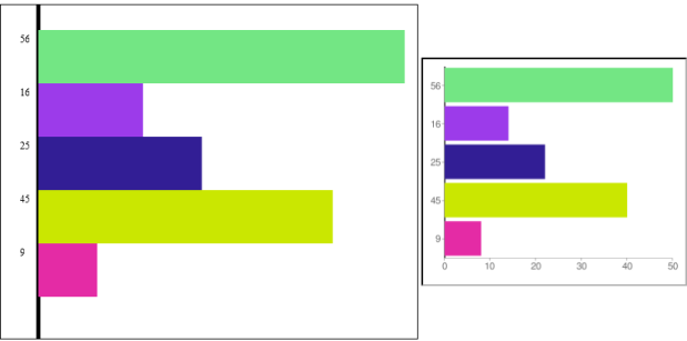
| 00:04, 12 June 2009 | Barchart2.png (file) |  |
23 KB | 4 | |
| 04:18, 7 November 2009 | Barchart2M.png (file) |  |
20 KB | 2 | |
| 00:05, 12 June 2009 | Barchart3.png (file) |  |
10 KB | 1 | |
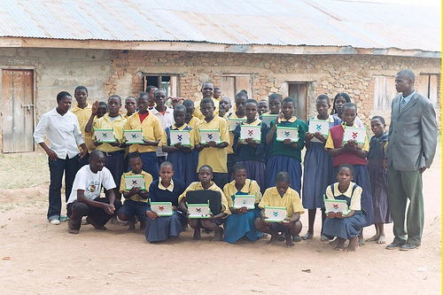
| 17:10, 30 December 2010 | BungomaXOProject.jpg (file) |  |
126 KB | http://www.smallsolutionsbigideas.org | 1 |
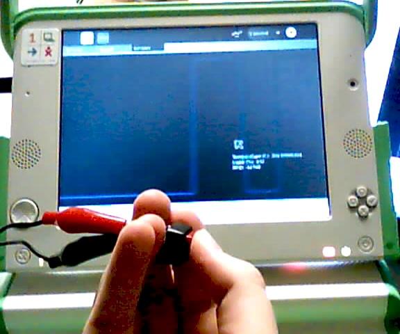
| 18:06, 26 June 2010 | ButtonOnscreen.jpg (file) |  |
35 KB | Using a switch, and its output in the Measure activity (DigiLiteracy mod) | 1 |
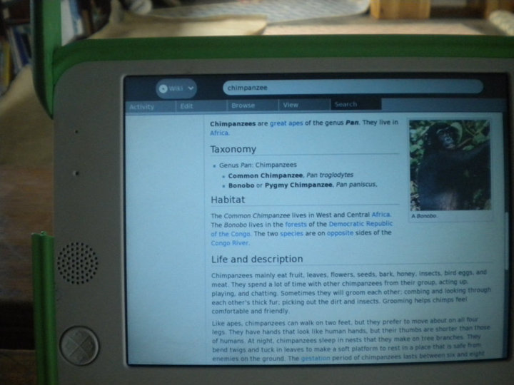
| 07:46, 1 September 2010 | ChimpWikiPack.jpg (file) |  |
67 KB | WikiPack can replace older, text-only, standard English Wikipedia articles in the WikiBrowse activity with up-to-date, photos-included, Simple English Wikipedia articles. This article about chimpanzees is much easier for students than http://en.wikip | 1 |
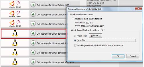
| 14:09, 23 December 2010 | FluendoScreen.jpg (file) |  |
23 KB | {{CC-BY-SA}} | 1 |
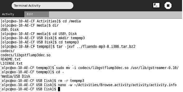
| 14:08, 23 December 2010 | FluendoTerminal.jpg (file) |  |
33 KB | {{CC-BY-SA}} | 1 |
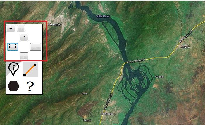
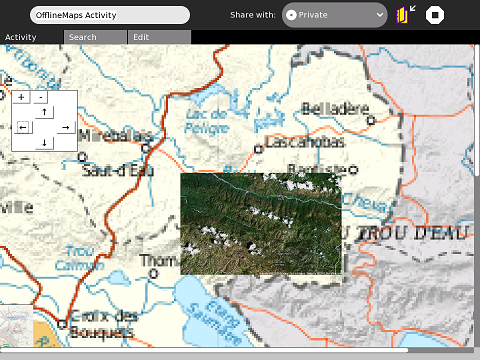
| 05:25, 18 April 2010 | Ghana1.jpg (file) |  |
61 KB | moving and zooming Ghana offline map | 1 |
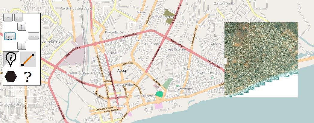
| 05:27, 18 April 2010 | Ghana2.jpg (file) |  |
91 KB | roadmap CC-BY-SA OpenStreetMap.org satellite map Bing Maps | 1 |
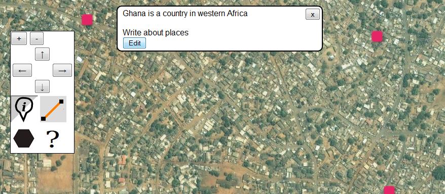
| 05:29, 18 April 2010 | Ghana3.jpg (file) |  |
91 KB | adding markers | 1 |
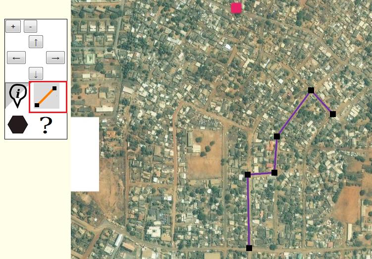
| 05:31, 18 April 2010 | Ghana4.jpg (file) |  |
97 KB | adding lines | 1 |
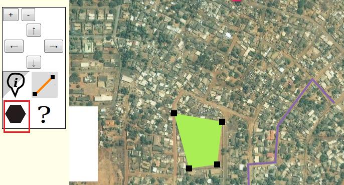
| 05:32, 18 April 2010 | Ghana5.jpg (file) |  |
64 KB | adding a polygon | 1 |
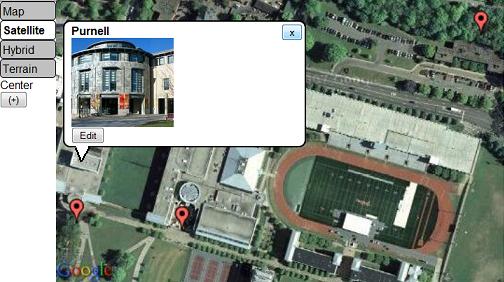
| 22:17, 28 January 2010 | GoogleMapEmbed.png (file) |  |
264 KB | {{CC-BY-SA}} Satellite image copyright of Google. Reproduced here for education / software tutorial purposes. | 1 |
| 19:48, 6 January 2011 | Haiti Ushahidi.jpg (file) |  |
122 KB | 1 | |
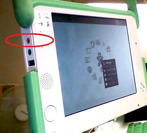
| 18:05, 26 June 2010 | HeadphonePort.jpg (file) |  |
26 KB | Attaching a sensor to the headphone port | 1 |
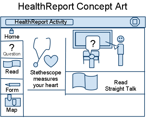
| 14:44, 24 September 2010 | HealthReportConceptArt.png (file) |  |
25 KB | {{CC-BY-SA}} | 1 |
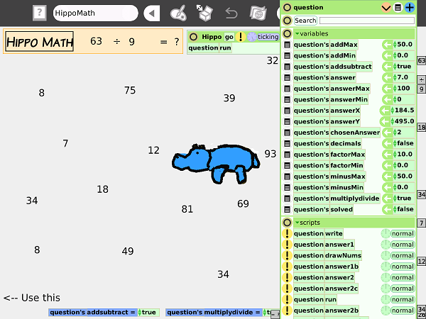
| 19:57, 8 April 2008 | HippoMathChanges.png (file) |  |
99 KB | Changing variables in HippoMath {{PD}} | 1 |
| 19:47, 8 April 2008 | HippoMathEbook.jpg (file) |  |
39 KB | Playing the HippoMath eToys game in eBook mode {{PD}} | 1 |
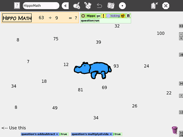
| 19:41, 8 April 2008 | HippoMathScreenshot.png (file) |  |
42 KB | Screenshot of HippoMath eToys game {{PD}} | 1 |
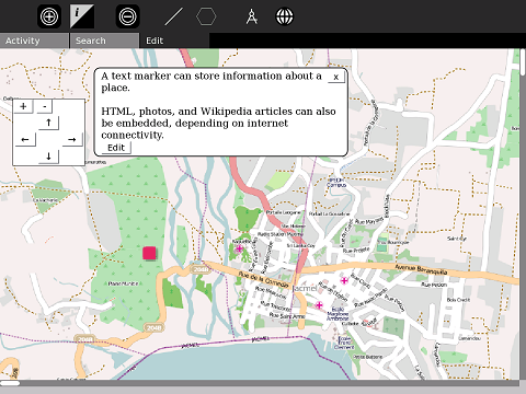
| 14:09, 5 September 2009 | InfoMarkers.jpg (file) |  |
34 KB | Satellite view and info markers in Map activity | 1 |
| 00:54, 12 February 2010 | JacmelMapped.png (file) |  |
160 KB | {{CC-BY-SA}} map of Jacmel by OpenStreetMap.org | 3 |
| 20:48, 25 August 2010 | KasiisiDoorSensor.jpg (file) |  |
81 KB | A door sensor was built for the Measure/Kasiisi activity | 1 |
| 00:16, 31 October 2010 | KasiisiMap.jpg (file) |  |
79 KB | Kasiisi Project {{CC-BY-SA}} | 1 |
| 00:01, 31 October 2010 | KasiisiPaperMap.jpg (file) |  |
68 KB | Kasiisi Project - showing visiting teachers a map of the school and surrounding area {{CC-BY-SA}} | 1 |
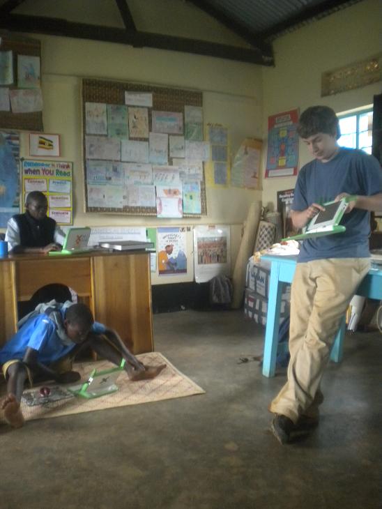
| 00:24, 31 October 2010 | KasiisiProgramming.jpg (file) |  |
61 KB | Kasiisi Project {{CC-BY-SA}} | 1 |
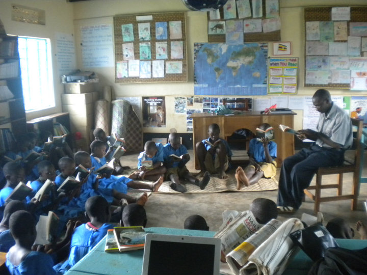
| 00:00, 31 October 2010 | KasiisiReaders.jpg (file) |  |
104 KB | Reading class at the Kasiisi Project in Uganda {{CC-BY-SA}} | 1 |
| 00:18, 31 October 2010 | KasiisiWaterTesting.jpg (file) |  |
26 KB | {{CC-BY-SA}} Water testing for World Water Monitoring Day | 1 |
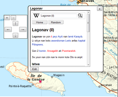
| 00:51, 25 January 2010 | LagonavWiki.png (file) |  |
89 KB | Embedding using '''wikiHT::''' code | 1 |
| 14:13, 23 December 2010 | LibrivoxScreen.jpg (file) |  |
23 KB | 2 | |
| 00:12, 12 June 2009 | Linechart1.png (file) |  |
6 KB | 2 | |
| 04:07, 7 November 2009 | Linechart1M.png (file) |  |
4 KB | 1 | |
| 00:12, 12 June 2009 | Linechart2.png (file) |  |
13 KB | 3 | |
| 04:08, 7 November 2009 | Linechart2M.png (file) |  |
19 KB | 1 | |
| 00:13, 12 June 2009 | Linechart3.png (file) |  |
9 KB | 2 | |
| 04:13, 7 November 2009 | Linechart3M.png (file) |  |
27 KB | 1 | |
| 00:13, 12 June 2009 | Linechart4.png (file) |  |
15 KB | 3 | |
| 00:13, 12 June 2009 | Linechart5.png (file) |  |
9 KB | 3 | |
| 00:18, 12 June 2009 | Linechart6.png (file) |  |
12 KB | 1 | |
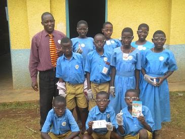
| 03:13, 27 March 2009 | Magongo.jpg (file) |  |
38 KB | 3 | |
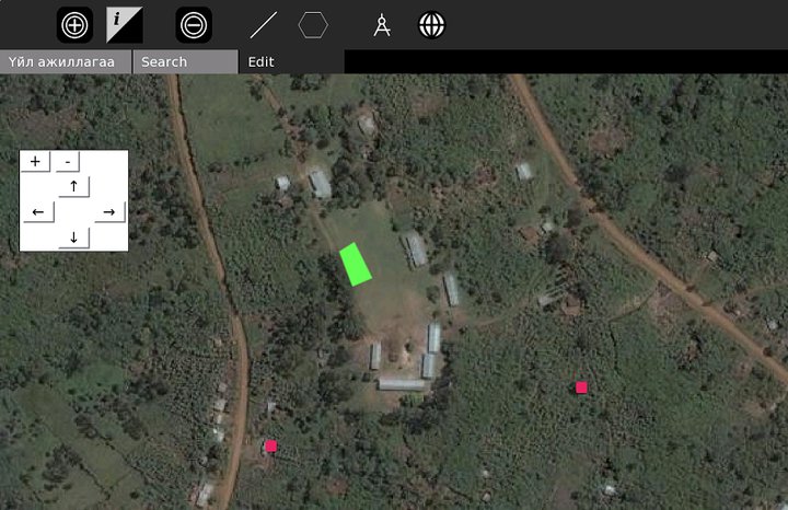
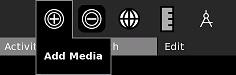
| 23:06, 25 August 2009 | Map-AddMedia.jpg (file) |  |
4 KB | Adding media to the new Map activity | 1 |
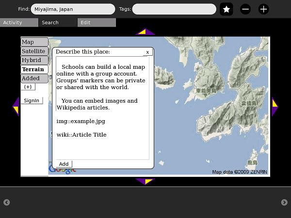
| 23:14, 25 August 2009 | Map-AddToWiki.jpg (file) |  |
42 KB | Adding a placemark to OurMaps, the map wiki | 1 |
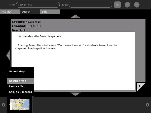
| 23:07, 25 August 2009 | Map-DescribeSaveMap.jpg (file) |  |
26 KB | Describing SaveMap objects in the new Map activity | 1 |
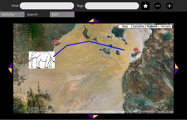
| 23:08, 25 August 2009 | Map-ElephantMap.jpg (file) |  |
52 KB | A sample map from the Map Library. This map illustrates a real-life use of GIS: conservation of elephants. | 1 |
| 23:14, 25 August 2009 | Map-EmbedWiki.jpg (file) |  |
43 KB | A frame from Simple Wikipedia's mobile site is embedded in this wiki-placemark | 1 |
| 21:28, 29 March 2010 | Map-InfoSelect.jpg (file) |  |
3 KB | updated, more obvious info marker | 2 |