User:Ndoiron
I am a volunteer for The Kasiisi Project in Uganda and the Digital Literacy Project in the Boston area. Outside of the OLPC world, I study civil engineering at Carnegie Mellon University (Pittsburgh, PA, USA).
Contents
Contact
Please e-mail ndoiron _at_ cmu.edu if you are interested in a project or have any questions
Experience in Uganda
Post-Uganda Summary & Photos
Uganda was awesome! It was great to teach and program in the field.
I taught an environmental sensing and maps class with The Kasiisi Project near Fort Portal, Uganda. The mission statement of the class became "Out of the Box" because not only were we trying new ways of learning, we were connecting our XOs with the world around us, outside the "box" of the laptop. You can find links to the activities, content, and hardware on my blog.
Technical Solutions from Kasiisi
These updates, written and tested at Kasiisi, can be applied to several activities worldwide.
- Bug fixes and keyboard interactions for Map and OfflineMap. Students had trouble with the mouse and sharing maps.
- Improved WikiBrowse with easier search, friendlier 404 page, addon articles ( see WikiPack )
- Redesign of Measure activity to assist teachers in explaining sensors and graphing.
- Improved SocialCalc with chart color selection, translatable chart UI, and full-screen HTML5 Canvas charts (for an offline deployment, the Google Chart frame was dead space)
Content from Kasiisi
- Add-on WikiPacks of up-to-date articles and photos from Simple English Wikipedia, which work both in Browse and in WikiBrowse.
- PhotoPacks from BigPicture blog - download an example
- BookPack with audiobook support
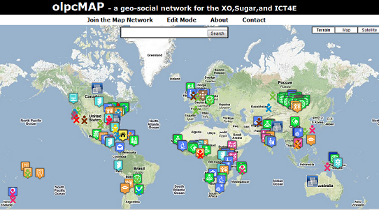
olpcMAP.net
Developing http://olpcMAP.net with the great team on the olpcMAP and olpcMAPmakers lists!
[Image:http://2.bp.blogspot.com/__rJtABokm_Q/TPmRcFBeGlI/AAAAAAAACwA/xWzdKl0A3-o/s1600/olpcmap.png]
Read the wiki article on uses and goals of OlpcMAP
See my marker at http://olpcMAP.net?id=359001 and use geo-queries such as http://olpcMAP.net?region=Mongolia and http://olpcMAP.net?region=Kenya&map=quick
Prior Work for the XO
- Major update to Map (activity) including offline mapping for Haiti, Uganda, and other countries. Maps can be customized using MapPacks.
- Adding bar, pie, line, and scatter charts to SocialCalc application
- Test (in Firefox or XO's Browse) here
- Users' Guide
- Mapping applications, introducing students to GIS and mapping
- Intro to Mapping Technology
- Explored SVG maps for classes without internet access
- Patch for the Geoquiz application